Photogrammetry workflow
Workflow details in development
We collect many partially overlapping drone photos across the site. This means any given tree appears in many photos, each from a slightly different angle.
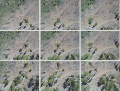
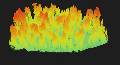
Because each tree is visible from multiple angles, it is possible to use methods related to stereo vision (specifically, photogrammetry) to estimate each tree’s 3D structure. The photogrammetry algorithm produces a 3D cloud of points that is very similar to lidar data.
The photogrammetry algorithm is also used to produce an orthomosaic, which is a high-resolution aerial image produced by stitching together the numerous drone photos. It resembles NAIP or Google Earth imagery but is generally much higher resolution (~ 3 cm).
Photogrammetric processing requires parameterization for the specific application. We have tested parameterizations for individual tree detection in structurally complex conifer forests and published our results, including recommended parameter values, in Methods in Ecology and Evolution. We also maintain a software library that makes it easy to run multiple photogrammetry workflows with pre-specified parameterizations in a documented, reproducible way.